![]()
![]()
Data Set |
Coverage |
Resolution |
Data format |
Date of data |
TERREL dataset keyword |
Global |
30 arc-second (~1 km) |
GeoTIFF |
2010 |
GEOTIFF |
|
ASTER 1 |
Global |
1 arc-second (~30m) |
GeoTIFF |
2011 |
GEOTIFF |
SRTM30 2 |
Global |
SRTM30: 30 arc-second (~1 km) |
SRTM |
2000 |
GTOPO30 |
SRTM3 1 |
Global |
SRTM3: 3 arc-second (~100m) |
SRTM |
2000 |
GEOTIFF |
GTOPO30 1 |
Global |
30 arc-second (~1 km) |
DEM |
1996 |
GEOTIFF |
|
|
|
|
|
|
U.S. |
SRTM1: 1 arc second (~30m) |
SRTM |
2000 |
GEOTIFF |
|
NED 3 |
U.S. |
2 arc-second (Alaska), |
ArcGrid, GridFloat, or IMG |
updated continually as new data become available |
GEOTIFF3 |
CDED 4 |
Canada |
0.75 arc-second (~23m) |
DEM |
2007 |
CDED |
IFSAR 1 |
Alaska |
|
GeoTIFF |
2010, 2012 |
GEOTIFF |
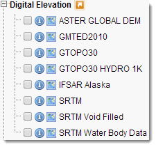
1Through the USGS Earth Explorer site, the following terrain data sets can be downloaded:
The selection of data is performed through a web interface that is easy to navigate: To narrow your search area: type in an address or place name, enter coordinates or click the map to define your search area (for advanced map tools, view the help documentation), and/or choose a date range.
GeoTIFF, DEM and SRTM formats are supported by TERREL used for terrain processing in CALMET/CALPUFF modeling.
The complete list of data formats supported by TERREL is:
| (USGS90) (USGS30) (ARM3) (3CD) (DMDF) (CDED) (SRTM1) (SRTM3) (GTOPO30) (USGSLA) (NZGEN) (GEN) (GEOTIFF) |
designates USGS 1-deg DEM files (~90m) designates USGS 7.5-min DEM files (typically 30m) designates ARM3 terrain data files(~900m) designates 3CD (binary) 1-deg DEM files (~90m) designates Canadian DMDF files (~100m) designates Canadian DEM files (3 and 0.75 arcsec) designates 1-sec Shuttle RADAR Topography Mission files (~30m) designates 3-sec Shuttle RADAR Topography Mission files (~90m) designates GTOPO30 30-sec data (~900m) designates USGS Lambert Azimuthal data (~1000m) designates New Zealand Generic data files designates Generic data files designates GEOTIFF data files |
2 SRTM30 global data on a ~1 km resolution can be downloaded directly from the SRTM FTP site. Files are named according to latitude and longitude (NW corner).
3 The USGS NED data over US can be downloaded through the USGS National Map Viewer. Data are stored in ArcGrid, GridFloat, or IMG formats, which are not supported by TERREL. The USGS also provides the explanation how to convert data in these formats to GeoTIFF.
4Canadian terrain data is provided in DEM format, compatible with TERREL, and can be downloaded through the GeoBase Web Site, at two resolutions: 0.75 arc-second data and 3 arc-second data. For both resolutions of Canadian data, user can select data to be downloaded through the map user interface.
~~~~~~~~~~~~~~~~~~~~~~~~~~~~~~~~~~~~~~~~~~~~~~~~~~~~~~~
Acronyms stand for:
GMTED2010: Global Multi-resolution Terrain Elevation Data 2010